Teaching
Courses Taught during my Tenure at UNCW
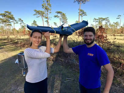
GGY 429/529 Aerial Drone Applications in Geosciences first offered Fall 2017(offered every Fall thereafter and in Spring 2023)
|

|
|
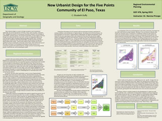
This UAS course will prepare students with the basic tools to go from drone to product. The class covers basics of remote sensing and photogrammetry, small UAS rules and regulations as per the Federal Aviation Administration, the hands-on operating procedures to get 3 different types of UAVs flying and collecting data and basics of data processing post-flight. Stay tuned for photos of this semester's experiences in the field and more!
GGY 281 Introduction to Geographic Information Systems (Fall 2013, Spring 2014 and every semester thereafter)

|

|

|
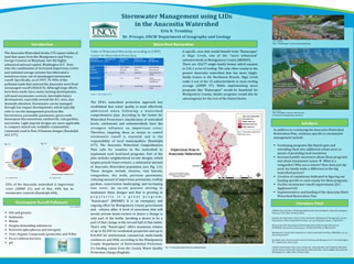
EVS281 is an applied class that provides a hands-on overview of vector and raster data models, basic geoprocessing and geosptial analysis and intro to field (GPS) data collection techniques. Since I am very keen on applied learning experiences and I have recently collaboratively secured funding from the UNCW eTEAL center, I have been incorporating more and more field mapping and data collection components into my EVS281 course. The images above were captured during the Fall 2014 UNCW forest trails mapping applied learning experience during which students were divided into groups and they mapped all the trails in the UNCW campus forest using Trimble Juno SB GPS devices and Lenovo tablets running ArcPad and paired with GPS devices. Each semester offers a different applied learning experience in this class
GGY480/GGY 592 The Human Footprint on the Landscape (Spring 2014), renamed GGY435 Environmental Geography in the future
he Human Footprint class is a socio-environmental immersion into understanding impacts humans have had on the natural environment, ranging from changes in the atmosphere, biosphere, hydrosphere, geosphere, cryosphere.
During Spring 2014, we had an amazing group of students who worked very passionately on creating a Prezi of human impacts on basins worldwide that are experiencing different degrees of conflict around water resources allocation (click to follow link). Using existing databases, online mapping resources, and current literature, we explored water-related conflicts and delved into the hydro-climatic, geomorphologic, and biotic characteristics of large river basins, including the Colorado, Usumacinta (Guatemala), the Nile, the Orange (South Africa), the Aral Sea (Syr Darya and Amu Darya), the Pearl River (China), the Murray-Darling (Australia) and the Solomon Islands watersheds. Our main goal was to explore current cooperative water management strategies in the face of global climate change and to understand how humans have been modifying these specific river basins and, ultimately, to extract some lessons learned and ones in progress. This class also resulted in the presentation of a poster entitled "H2Oh No!: Rebalancing the Water and Political Power Equation", presented at the Center of Support of Undergraduate Research and Fellowships Undergraduate Showcase. University of North Carolina Wilmington. April 2014.
During Spring 2014, we had an amazing group of students who worked very passionately on creating a Prezi of human impacts on basins worldwide that are experiencing different degrees of conflict around water resources allocation (click to follow link). Using existing databases, online mapping resources, and current literature, we explored water-related conflicts and delved into the hydro-climatic, geomorphologic, and biotic characteristics of large river basins, including the Colorado, Usumacinta (Guatemala), the Nile, the Orange (South Africa), the Aral Sea (Syr Darya and Amu Darya), the Pearl River (China), the Murray-Darling (Australia) and the Solomon Islands watersheds. Our main goal was to explore current cooperative water management strategies in the face of global climate change and to understand how humans have been modifying these specific river basins and, ultimately, to extract some lessons learned and ones in progress. This class also resulted in the presentation of a poster entitled "H2Oh No!: Rebalancing the Water and Political Power Equation", presented at the Center of Support of Undergraduate Research and Fellowships Undergraduate Showcase. University of North Carolina Wilmington. April 2014.
|
|
|
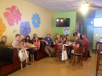
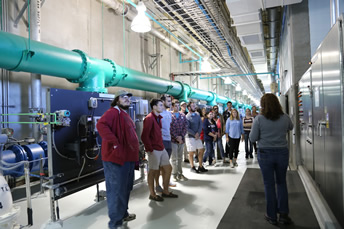
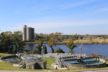
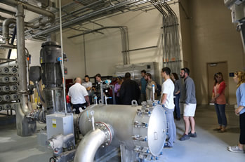
In this applied learning course, we use the latest scientific understanding to analyze issues of water availability, access, allocation and scarcity from a hydrologic, legal, socio-economic, political and management perspective. Students complete a series of watershed explorations meant to immerse them sequentially into multifarious aspects of water resources science, policy, management and emerging issues. These weekly explorations culminate in a term project that is presented in a multi-media fashion. The class also includes guest speakers, a water privatization debate, a fieldtrip to the water and wastewater treatment plants in the Wilmington NC area (photos above), and other applied learning components
GGY473 Regional and Environmental Land Use Planning (Spring 2015, every other Fall afterwards)
This applied learning course aims to equip students with a broad knowledgebase primarily focused on landscape components and processes. Throughout the semester, students develop the necessary land use analysis and management skills in order to help guide land use decision-making, stakeholders engagement processes, and minimize/mitigate conflict between natural and built systems in an effort to produce more sustainable land use patterns and plans. Specifically, students select a region, assess the historical and present environmental and land use planning conditions, and conduct research on a projected or potential future land use or environmental planning issue using acquired land use plans, spatially-explicit databases and GIS modeling and other appropriate resources and methods, including stakeholder phone or in-person interviews. Below are some examples of original projects that resulted from our Spring 2015 class that were presented by GGY473 students at the UNCW Spring Research Symposium.
This applied learning course aims to equip students with a broad knowledgebase primarily focused on landscape components and processes. Throughout the semester, students develop the necessary land use analysis and management skills in order to help guide land use decision-making, stakeholders engagement processes, and minimize/mitigate conflict between natural and built systems in an effort to produce more sustainable land use patterns and plans. Specifically, students select a region, assess the historical and present environmental and land use planning conditions, and conduct research on a projected or potential future land use or environmental planning issue using acquired land use plans, spatially-explicit databases and GIS modeling and other appropriate resources and methods, including stakeholder phone or in-person interviews. Below are some examples of original projects that resulted from our Spring 2015 class that were presented by GGY473 students at the UNCW Spring Research Symposium.
|
|
|
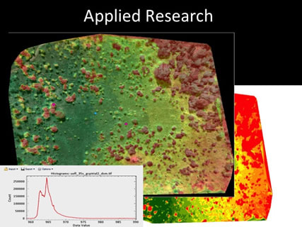
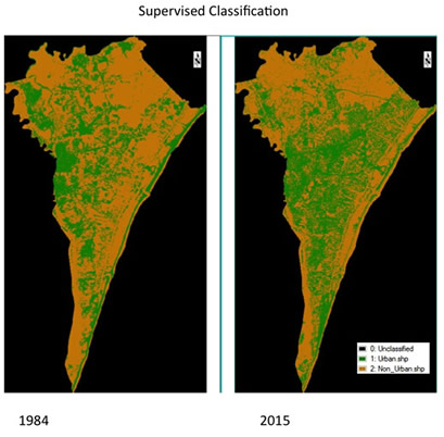
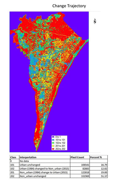
GGY 522 Remote Sensing in Environmental Analysis (Spring 2016 and every spring thereafter)
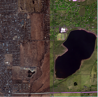
This course provides an introduction to the acquisition and utilization of remotely-sensed data in geographical and environmental research. The different sensors used to collect this information along with the widely varying techniques employed to analze and display these remotely-sensed data are being developed at an astounding rate. In this course, the predominant focus will be on the interpretation and application of data from space-borne imaging systems (eg: MODIS, Landsat, SPOT, WorldView, AVHRR). The goal of this course is to facilitate students’ understanding and use of remote sensing data from a spatiotemporal perspective. Students will develop a comprehensive understanding of remote sensing principles and methods through applications in geography and environmental science. In addition, direction will be given towards how remote sensing may be applied to students’ research and towards hands-on skills for processing, analysis, display and communication of remote sensing data. Transitioned to implementation in Google Earth Engine in Spring 2023.
This course provides an introduction to the acquisition and utilization of remotely-sensed data in geographical and environmental research. The different sensors used to collect this information along with the widely varying techniques employed to analze and display these remotely-sensed data are being developed at an astounding rate. In this course, the predominant focus will be on the interpretation and application of data from space-borne imaging systems (eg: MODIS, Landsat, SPOT, WorldView, AVHRR). The goal of this course is to facilitate students’ understanding and use of remote sensing data from a spatiotemporal perspective. Students will develop a comprehensive understanding of remote sensing principles and methods through applications in geography and environmental science. In addition, direction will be given towards how remote sensing may be applied to students’ research and towards hands-on skills for processing, analysis, display and communication of remote sensing data. Transitioned to implementation in Google Earth Engine in Spring 2023.
|
|
|