Working with Dr. Narcisa Pricope

pricope_cv_sept_2023.pdf DR. NARCISA GABRIELA PRICOPE
Curriculum Vitae (PDF)
Welcome to my webpage and thank you for visiting!
I am an Associate Vice President for Research in the Office of Research and Economic Development at Mississippi State University and a Professor in the Department of Geosciences at Mississippi State University. Prior to joining Mississippi State University, I was a Professor of Geography and Geospatial Sciences at University of North Carolina Wilmington for ten years where I progressed through the academic ranks from assistant to full professor by 2021. During my tenure at UNCW, I served as the Founder and Director of the University of North Carolina Wilmington (UNCW) Geospatial Intelligence program, FAA Collegiate Training Initiative and Coastal UAS Observatory funded by the National Science Foundation, initiatives aimed at training the next generation of geospatial scientists by conducting cutting-edge research. I was also the UNCW leader and program manager for the first National Geospatial Intelligence Agency (NGA) GEOINT Learning through Academic Programs (GLAP) $5 million contract awarded to academic institutions. While at UNCW, I received numerous awards for research and student mentorship, including the 2021 UNCW College of Arts and Sciences Research Award and the 2022 UNCW Graduate Faculty Mentor Award and Discere Aude mentorship award, in addition to research funding from sources including NSF, NASA, NCDOT, NOAA Sea Grant, USAID, World Bank and the Global Environment Facility.
My academic career started as an assistant professor in the Environmental Studies Department at Southern Oregon University and a Visiting Researcher with the Climate Hazards Group and the Human-Environment Dynamics Lab in the Geography Department at University of California Santa Barbara. Between 2006 and 2010, I was a National Science Foundation Interdisciplinary Graduate Education and Traineeship (IGERT) research associate at the University of Florida where I earned a PhD in Geography, with a minor in Environmental Engineering in 2011. Prior to that, I earned my Master’s of Science degree in Geosciences from Western Kentucky University (2006) where I combined my love of rivers and caves with water quality monitoring programs and modeling landscape-level soil erosion in an agricultural watershed. I received my Bachelor’s degree in Geography and English in 2004 from Babes-Bolyai University in Cluj-Napoca, Romania, where I simultaneously explored my passions at the time: geomorphology, GIS and foreign languages.
My current work and the combined efforts of our lab members focus on applied questions at the intersection between land change science, watershed science, and population geography. My overarching interest and long-term focus revolves around understanding the vulnerability of different populations to environmental change in the context of transboundary-managed water and natural resources. I examine the drivers, patterns and impacts of vegetation change and degradation on both ecosystems and people particularly in southern and eastern African drylands as well as in the coastal regions of North America. Last but absolutely not least, I love working with and supporting my students in achieving their dreams and career goals and including them in all aspects of my research on four continents!
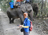
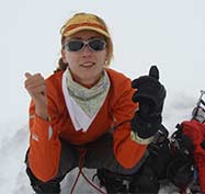
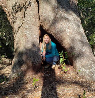
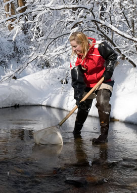
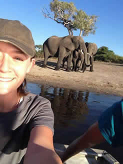
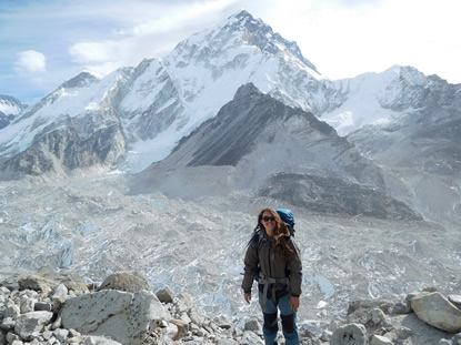
I am an avid traveler, explorer, mountaineer and skier (or used to be before I had kids and moved to flat North Carolina!!). During the half year spent in Nepal in 2009 as a field research assistant, I trekked for weeks in six of Nepal’s national parks and climbed to a little over 6500 m, to gain some spectacular views of the world’s highest mountain and much of the Nepali Himalaya Mountains from Mera Peak. I grew up literally on the banks of a large mountain stream in western Romania, in a large depression surrounded by spectacular mountains on all sides which I was enamored with and explored from an early age. I am also a cave explorer and mapper, having descended into the world’s largest cave system (Mammoth Cave) on a bi-weekly basis for work purposes for a year and participated in mapping swaths of the unexplored caves on Isla Mona, in Puerto Rico. I love Africa: from the smell in the air as the airplane opens its doors (even in Johannesburg!) to the wonderfully friendly and warm people, the endless plains of grass scattered with trees and wildlife and the hardships of doing fieldwork under constant threat from elephants, hyenas and other majestic creatures. I love traveling, dipping into local history and culture, and getting lost in unfamiliar places! And I really enjoy meeting new people, making new friendships, and cutting across cultural boundaries only to discover that laughter and kindness are a language we all understand, irrespective of our cultural background. But above all, I love spending time with my little nugget of energy, Dalia, who's made life that much more interesting and constantly keeps me on my toes. And if Dalia wasn't enough to keep me on my toes, I have now added baby girl Hedi to really make sure I'm never not on my toes!
Curriculum Vitae (PDF)
Welcome to my webpage and thank you for visiting!
I am an Associate Vice President for Research in the Office of Research and Economic Development at Mississippi State University and a Professor in the Department of Geosciences at Mississippi State University. Prior to joining Mississippi State University, I was a Professor of Geography and Geospatial Sciences at University of North Carolina Wilmington for ten years where I progressed through the academic ranks from assistant to full professor by 2021. During my tenure at UNCW, I served as the Founder and Director of the University of North Carolina Wilmington (UNCW) Geospatial Intelligence program, FAA Collegiate Training Initiative and Coastal UAS Observatory funded by the National Science Foundation, initiatives aimed at training the next generation of geospatial scientists by conducting cutting-edge research. I was also the UNCW leader and program manager for the first National Geospatial Intelligence Agency (NGA) GEOINT Learning through Academic Programs (GLAP) $5 million contract awarded to academic institutions. While at UNCW, I received numerous awards for research and student mentorship, including the 2021 UNCW College of Arts and Sciences Research Award and the 2022 UNCW Graduate Faculty Mentor Award and Discere Aude mentorship award, in addition to research funding from sources including NSF, NASA, NCDOT, NOAA Sea Grant, USAID, World Bank and the Global Environment Facility.
My academic career started as an assistant professor in the Environmental Studies Department at Southern Oregon University and a Visiting Researcher with the Climate Hazards Group and the Human-Environment Dynamics Lab in the Geography Department at University of California Santa Barbara. Between 2006 and 2010, I was a National Science Foundation Interdisciplinary Graduate Education and Traineeship (IGERT) research associate at the University of Florida where I earned a PhD in Geography, with a minor in Environmental Engineering in 2011. Prior to that, I earned my Master’s of Science degree in Geosciences from Western Kentucky University (2006) where I combined my love of rivers and caves with water quality monitoring programs and modeling landscape-level soil erosion in an agricultural watershed. I received my Bachelor’s degree in Geography and English in 2004 from Babes-Bolyai University in Cluj-Napoca, Romania, where I simultaneously explored my passions at the time: geomorphology, GIS and foreign languages.
My current work and the combined efforts of our lab members focus on applied questions at the intersection between land change science, watershed science, and population geography. My overarching interest and long-term focus revolves around understanding the vulnerability of different populations to environmental change in the context of transboundary-managed water and natural resources. I examine the drivers, patterns and impacts of vegetation change and degradation on both ecosystems and people particularly in southern and eastern African drylands as well as in the coastal regions of North America. Last but absolutely not least, I love working with and supporting my students in achieving their dreams and career goals and including them in all aspects of my research on four continents!
I am an avid traveler, explorer, mountaineer and skier (or used to be before I had kids and moved to flat North Carolina!!). During the half year spent in Nepal in 2009 as a field research assistant, I trekked for weeks in six of Nepal’s national parks and climbed to a little over 6500 m, to gain some spectacular views of the world’s highest mountain and much of the Nepali Himalaya Mountains from Mera Peak. I grew up literally on the banks of a large mountain stream in western Romania, in a large depression surrounded by spectacular mountains on all sides which I was enamored with and explored from an early age. I am also a cave explorer and mapper, having descended into the world’s largest cave system (Mammoth Cave) on a bi-weekly basis for work purposes for a year and participated in mapping swaths of the unexplored caves on Isla Mona, in Puerto Rico. I love Africa: from the smell in the air as the airplane opens its doors (even in Johannesburg!) to the wonderfully friendly and warm people, the endless plains of grass scattered with trees and wildlife and the hardships of doing fieldwork under constant threat from elephants, hyenas and other majestic creatures. I love traveling, dipping into local history and culture, and getting lost in unfamiliar places! And I really enjoy meeting new people, making new friendships, and cutting across cultural boundaries only to discover that laughter and kindness are a language we all understand, irrespective of our cultural background. But above all, I love spending time with my little nugget of energy, Dalia, who's made life that much more interesting and constantly keeps me on my toes. And if Dalia wasn't enough to keep me on my toes, I have now added baby girl Hedi to really make sure I'm never not on my toes!

|
|
UNCW SEA Lab Graduate Student Researchers
 LUKAS FARLOW
I am Lukas Farlow and I am a second-year graduate student at UNCW under the mentorship of Dr. Pricope, pursuing a master’s in Geoscience with a focus on Geospatial Technologies. I originally considered the field of Environmental Science as my interests are deeply rooted in the natural sciences and conservation. A desire to develop my skills into a specialization that could serve these interests led me to Dr. P and other students pursuing the cutting-edge technologies that are revolutionizing the fields of GIS and Remote Sensing. Dr. Pricope’s leadership has equipped me well for several professional opportunities, including internships at the NC Coastal Federation, Geosyntec Consultants, and Geo Owl. I have spent my time in graduate school developing the first-ever prescribed fire needs assessment for North Carolina and am currently employed at FirmaTek as a Geospatial Engineering Technician. In the future, I hope to specialize in the use of LiDAR and photogrammetry as a certified UAS pilot and help support a global infrastructure that powers humankind through clean energy and sustainability. Today I enjoy exploring new locales and wildernesses, playing beach volleyball with friends, and the occasional narrative-driven adventure on my PlayStation.
 ELIJAH DALTON
My name is Elijah Dalton and I am a first year master’s degree candidate in the Department of Earth and Ocean Sciences, thesis in Geospatial Science, at the University of North Carolina Wilmington. In spring 2022, I received a B.S. in Environmental Science with a concentration in biological sciences and a B.A. in Geography from the UNCW. During my undergrad I worked with Dr. Pricope on an undergraduate honors thesis titled, ‘Comparing Metrics of Wetland Vegetation Structure Derived from UAS Photogrammetry and UAS LiDAR Data Collections’. After graduating, I interned with NASA’s National DEVELOP Program as a NC Space Grant recipient on a project titled, ‘Improving Crop Classification Mapping Using Optical and Radar Satellite Sensors to Enhance Agricultural Management and Policy Making in Mato Grosso, Brazil’. During this time I also received my FAA Drone Certification. For my thesis research, I will be using Google Earth Engine and Earth observation data from Dr. Pricope’s NASA ROSES grant to develop green infrastructure solutions to support flood mitigation and adaptation in coastal low-lying disadvantaged communities.
I hope to graduate in the fall of 2023 and enter the workforce where I can apply the advanced geospatial skillsets I have gained in this program to tackle complex human-environment topics. Outside of school and work, I enjoy kayaking, hiking, and camping with my fiancé.
I hope to graduate in the fall of 2023 and enter the workforce where I can apply the advanced geospatial skillsets I have gained in this program to tackle complex human-environment topics. Outside of school and work, I enjoy kayaking, hiking, and camping with my fiancé.
 TRAVIS DIETZ
My name is Travis Deitz, and I am a first-year graduate student in the University of Wilmington's Geosciences program, where I plan to focus on geospatial technologies. I received a B.A. in Homeland Security while serving in the United States Navy as an unmanned aerial vehicle (UAV) operator. During my time in the service, I noticed many shortfalls with our current drone technology, which has led me to pursue learning more about how various sensor and drone technologies can fill those gaps. My personal interest includes roasting coffee, learning astrophotography, skydiving, and flying various small drones for work and fun.
 Salman Bashit
I am Salman Bashit. I am doing my master's at the University of North Carolina Wilmington and my major is Geoscience with a geospatial science concentration. I have completed a Bachelor of Urban and Rural Planning (BURP) degree from Khulna University, Bangladesh. During my undergraduate degree, I got interested in spatial analysis, land use land cover change analysis using GIS and Remote sensing technologies. I am doing my research on “Creating Practicability Envelopes for UAS Topo bathymetric LiDAR Collections in Coastal Regions.” Also, I am working as a research assistant for Socio-Environmental Analysis Lab (SEAL), Earth and Ocean Sciences department led by Professor Dr. Narcisa Pricope. Currently, I am working on a project funded by the North Carolina Department of Transportation (NCDOT). Primarily my research interest is remote sensing, GIS, and its applications in the environment, land change science, urban studies, and disaster science. I feel very fortunate to get the opportunity to work with Dr. Narcisa Pricope. She is just an incredible mentor and I am hoping under her mentorship I am going to experience some cutting-edge technologies like drone-mounted topo-bathymetric LiDAR. Moreover, working here for the SEAL lab widens my viewpoints and research skills constantly.
 Beth McCroskey
Hi! My name is Beth McCroskey and I am a first year graduate student in the Department of Earth and Ocean Sciences at UNCW. I am currently pursuing my Geoscience M.S. with a concentration in Geospatial Science. My thesis research is funded by the FAO and will use remote sensing techniques to look at land cover in Ethiopia to establish possible grazing ranges for cattle. This degree route is quite a change from my undergrad studies where I received my B.S. in Zoology from North Carolina State University. With the different types of technology I will be learning throughout my studies, I am looking forward to melding these two interests in the job market upon my graduation. Being a huge animal lover has shaped many of my interests as well as setting the stage for my travel destinations. Whether it is swimming with sharks, feeling the rattle of a Canebrake rattlesnake in my palm (I was assisting in it being measured), being in open waters with whale sharks, raising and rehabbing a newborn squirrel, listening to the roar of a troop of Howler monkeys overhead deep in the Belizean jungle, getting up close with a coatimundi or finding Eyelash vipers along a trail, nature dictates many aspects of my life. I try to travel as often as I can and anytime I can be in the water swimming or snorkeling, I feel at home.
Current Undergraduate Student Researchers
SEA Lab Graduate Student Alumi
 BRITTON J. BAXLEY
My name is Britton Baxley and I am a first year master’s candidate for Geosciences here at the University of North Carolina Wilmington. I received a B.S. in Environmental Studies for conservation and a minor in GIS in 2015 as an undergraduate at UNCW. Before transferring to UNCW I had tried several degree paths but found a true calling for environmental work here in NC’s unique and diverse ecosystems. During my studies, GIS became a dedicated passion while working with Dr. Pricope through remote sensing, analysis and map making. As a graduate student alongside Dr. Pricope I hope develop a thesis to work with emergent technologies such as drones to answer ecological issues that NC faces today and will continue to face in the future. In addition I hope to acquire a post-baccalaureate certificate in GIS and my FAA drone certification. My research interests encompass using remote sensing, photogrammetry, and image classification to help answer environmental and ecological questions. I am currently an intern for the US Army Corps of Engineers working with river basin flood mapping and modeling as well as coastline image collection. In my personal time I enjoy most any outdoor activities from kayaking, to surfing, to climbing, and much more.
Publications while at UNCW:
Pricope, N.G., Mapes, K., Woodward*, K., Olsen, S. and Baxley*, B. 2019. Multi-sensor assessment of the effects of varying processing parameters on UAS product accuracy and quality. Drones 2019, 3, 63.
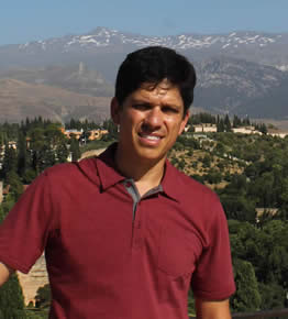 CHRISTOPHER HIDALGO
My name is Chris Hidalgo and I graduated from UNCW in May 2018 with a B.A. in Recreation, Sports Leadership, and Tourism Management. I am second year graduate student studying Geoscience and concentrating on geographic information systems (GIS). My thesis, with the aid of a UNCW Community Engagement Grant with Pender and Craven counties, focuses on the flooding effects on residential structures in southeastern North Carolina following Hurricane Florence. Prior to pursuing higher education I served in the United States Marine Corps as an Arabic cryptologic linguist. My personal interests include bicycling, learning foreign languages, indoor rock climbing, and taking cooking classes with my wife when traveling.
Publications while at UNCW:
Pricope, N.G., Hidalgo*, C., Pippin, J.S. and Evans, S. 2022. Shifting landscapes of risk: quantifying pluvial flood vulnerability beyond the regulated floodplain. Journal of Environmental Management 304 (2022) 114221: https://doi.org/10.1016/j.jenvman.2021.114221
Pricope, N.G., Halls, J., Rosul*, L., and Hidalgo*, C. 2019. Residential flood vulnerability along the developed North Carolina, USA coast: high resolution social and physical data for decision support. Data in Brief 24 (2019) 103975: 1-7 https://doi.org/10.1016/j.dib.2019.103975
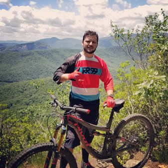 HUNTER SYNAN
I am a second-year graduate student in the M.Sc. Geoscience Program. My thesis research involves using satellite and drone imagery to classify, model, and predict harmful algal blooms in rivers, lakes, and estuaries.
Prior to graduate school at UNCW, I attended Carteret Community College in Morehead City, NC where I received both an A.A.S. and a degree in Aquaculture Technology in 2015. I then transferred into UNCW’s Marine Biology Program after, studying shellfish aquaculture. From 2016 to 2018, I worked for Dr. Ami Wilbur at UNCW’s Shellfish Research Hatchery studying shellfish genetics and selective breeding. In the fall semester of 2016, I was enrolled in my first GIS class with Dr. Narcisa Pricope. It was in this class that I found a love for GIS, and my skill for spatial thinking. I continued learning more about GIS by enrolling in the Geospatial Technologies Minor. I graduated from UNCW with a B.S. in Marine Biology and a Minor in Geospatial Technologies in 2018. Now, it is my goal to use GIS as a tool to offer new information about aquatic ecosystems.
Outside of school and work, I am either surfing some gnarly waves, SCUBA diving, or shredding some sketchy downhills in Pisgah National Forest on my mountain bike.
 KYLE D. WOODWARD
I’m a second-year master’s degree candidate in the Department of Earth and Ocean Sciences, concentrating in Geospatial Science. In 2017 I received a B.S. in Geographic Science from James Madison University where I dual concentrated in Environmental Conservation and Applied Geographic Information Systems. After graduation I entered the workforce as a GIS Technician in the engineering/infrastructure consulting industry, but within a year I decided I wanted a deeper dive into environmental applications of geospatial science. I spent the majority of the summer in 2018 conducting fieldwork in southern Africa under Dr. Pricope’s NSF grant, where we collected new data that will help us understand how people and the environment are adapting to an increasingly variable climate. We collected drone imagery of a spectrum of representative landscapes, conducted land use-land cover reference samples with GPS, and I assisted our socio-ecology collaborators in the household interviewing and participatory mapping efforts of community natural resource areas in our Botswana and Zambia study areas. For my thesis research, I will be using several of these datasets to explore whether various types of land use activities within the community resource areas can be detected and differentiated with the use of remote sensing and statistical data mining.
I spent the summer of 2019 as a GIS/Imagery Intern at the US Army Corps of Engineers and a NASA NC Space Grant Graduate Research Fellow. I hope to graduate in the spring of 2020 and re-enter the workforce where I can apply the advanced geospatial skillsets I’ve gained in this program to tackle complex human-environment topics.
Publications while at UNCW:
Woodward*, K.D., Pricope, N.G., Stevens, F., Gaughan, A., Drake*, M., Bailey, K., Salerno, J., Cassidy, L., Kolarik*, N., and Hartter, J. 2021. Modeling community land use in a transboundary Southern African landscape: integrating remote sensing and participatory mapping. Remote Sensing 13 (4), 631. https://doi.org/10.3390/rs13040631
Kolarik*, N., Gaughan, A., Stevens, F., Pricope, N.G., Woodward*, K., Cassidy, L., Salerno, J., and Hartter, J. 2020. A multi-plot assessment of vegetation structure using a micro-unmanned aerial system (UAS) in a semi-arid savanna environment. ISPRS Journal of Photogrammetry and Remote Sensing 164, 84-96.
Pricope, N.G., Mapes*, K.L. and Woodward*, K.D. 2019. Remote sensing of human-environment interactions in global change research: a review of advances, challenges and future directions. Remote Sensing 2019, 11, 2783.
Pricope, N.G., Mapes*, K., Woodward*, K., Olsen*, S. and Baxley*, B. 2019. Multi-sensor assessment of the effects of varying processing parameters on UAS product accuracy and quality. Drones 2019, 3, 63.
Bailey, K., Drake*, M., Salerno, J., Cassidy, L., Gaughan, A., Stevens, F., Pricope, N.G., Woodward*, K.D., Luwaya, H.M. and Hartter, J. 2020. Mapping Natural Resource Collection Areas from Household Survey Data in Southern Africa. Applied Geography Vol. 125, December 2020, 102326.
Salerno, J., Stevens, F., Gaughan, A., Hilton, T., Bailey, K., Bowles, T., Cassidy, L., Mupeta-Muyamwa, P., Biggs, D., Pricope, N.G., Mosimane, A.W., Henry, L.M., Drake*, M., Weaver*, A., Kosmas, S., Woodward*, K., Kolarik*, N., and Hartter, J. 2021. Wildlife impacts and changing climate pose compounding threats to human food security. Current Biology 31, 1-9. https://doi.org/10.1016/j.cub.2021.08.074
Gaughan, A., Kolarik*, N., Stevens, F., Pricope, N.G., Cassidy, L., Salerno, J., Bailey, K., Drake*, M., Woodward*, K., and Hartter, J. 2022. Using very high resolution multispectral classification to estimate savanna fractional vegetation coverage. Remote Sensing 14(3):551. https://doi.org/10.3390/rs14030551
 EILEEN O'CONNOR PYE
My name is Eileen O’Connor Pye and I am a first year graduate student in the Geoscience Program at UNCW. My previous studies include Marine Technology (A.A.S.) at Cape Fear Community College and Environmental Science (B.S.) at UNCW.
Between undergraduate school and starting graduate school, I have worked a variety of jobs. I’ve been a counselor for UNCW’s Marine Quest program, an analytical chemist for Quality Chemical Laboratories, an electrician, a NOAA Corps officer for the National Oceanic & Atmospheric Administration and more recently a Captain for Sea Legs Pedal Boat in Carolina Beach. You could say I am well-rounded.
Now, I am looking forward to this new chapter of continuing a higher education in Geoscience with a Geospatial Science Concentration. While I have yet to develop my thesis, I am interested in a project that researches flooding in the southeastern U.S. and the related consequences and issues that occur from these events.
 KERRY L. MAPES
I am an M.S. Geoscience candidate in the Department of Earth and Ocean Sciences. I began my college career at West Chester University of Pennsylvania in my hometown in the B.S. Biology (Ecology and Conservation) program, where I graduated cum laude in December 2012. I think my interest in ecology, primarily of forests and streams, began in my childhood which was spent exploring the woods and small creek behind my house. As my town grew, development altered the landscapes and I watched over the years as the stream and forest changed. It didn’t occur to me until many years later that this was something that people studied, but it is now the primary focus of my thesis research at UNCW. I am very interested in how human land use and deforestation impacts local watersheds and stream biota, and how forested stream buffers can be utilized to mitigate these impacts and improve water quality and habitat in streams. I have previously worked in the entomology lab at Stroud Water Research Center in Avondale, PA, helping to sample and identify aquatic macroinvertebrates used in water quality analyses. I am certified with the Society of Freshwater Science for macroinvertebrate identification to the family level and will integrate my previous experience, and my knowledge of stream ecology, into my research. I hope to map land use and land cover change in the Cape Fear Watershed and correlate existing water quality data to examine impacts through time. I love interacting with people in the local communities and getting others excited about freshwater conservation and hope to organize outreach projects such as education and buffer plantings.
We would like to congratulate UNCW Geoscience MSc student and Socio-Environmental Analysis lab fellow, KERRY MAPES, on being awarded a prestigious Ahuja Academy of Water Quality Fellowship for this academic year. In her own words: "Being nominated for and being awarded the Ahuja Fellowship is such an honor for me. All the support I have received since I began at UNCW has enabled me to connect with so many other people who share one vision and one goal of protecting our precious water resources. My specific purpose is to increase unbiased, scientific research that ultimately leads to improvements in water quality so our children have a future with a clean, secure water source. "
Kerry is now a research associate in the Geosaptial Service Group (founded by Dr. Pricope in January 2018) at UNCW and working on a multitude of research projects in that capacity. Publications while at UNCW:
Mapes*, K.L.; Pricope, N.G.; Baxley*, J.B.; Schaale*, L.E.; Danner, R.M. 2020. Thermal Imaging of Beach-Nesting Bird Habitat with Unmanned Aerial Vehicles: Considerations for Reducing Disturbance and Enhanced Image Accuracy. Drones 2020, 4, 12.
Mapes*, K.L. and Pricope, N.G. 2020. Evaluating SWAT model performance for runoff, percolation, and sediment loss estimation in low-gradient watersheds of the Atlantic Coastal Plain. Hydrology 7,21.
Pricope, N.G., Mapes*, K., Woodward*, K., Olsen*, S. and Baxley*, B. 2019. Multi-sensor assessment of the effects of varying processing parameters on UAS product accuracy and quality. Drones 2019, 3, 63.
Pricope, N.G., Mapes*, K.L. and Woodward*, K.D. 2019. Remote sensing of human-environment interactions in global change research: a review of advances, challenges and future directions. Remote Sensing 2019, 11, 2783.
 JERI BURKE, 2015
My name is Jeri Burke and I am a second year Masters student at the University of North Carolina at Wilmington. My research interests include land change science and hydrogeology, particularly mapping flooding patterns and examining how they change through time and impact the surrounding ecosystems. I began my journey at UNCW with the intention of studying paleoecology, but a presentation given by Dr. Pricope about her work in Africa completely changed my academic path. I was inspired by the power of remote sensing and GIS to answer important questions around the world. I have loved Africa since a young age and was lucky enough to complete my fieldwork examining the flooding patterns of the Chobe River in Namibia and Botswana in the summer of 2014. Dr. Pricope and I collected training samples at numerous locations along the floodplain as well as on the surrounding rivers and lakes. I was able to receive invaluable input from people living on the rivers, those working for hydrologic agencies, and even professors from local universities.
UPDATE: Jeri completed her Master's thesis in May 2015. Her final project was entitled: " Modeling Surface Inundation and Flood Risk in a Flood Pulsed Savannah: Chobe River, Botswana and Namibia" and a PDF copy of her thesis project is also available here.
Publication resulting from this work: Burke*, J.J., Pricope, N.G., and Blum, J. 2016. Thermal Imagery-Derived Surface Inundation Modeling to Assess Flood Risk in a Flood-Pulsed Savannah Watershed in Botswana and Namibia. Remote Sensing 2016, 8, 676; doi:10.3390/rs8080676
 ALYSSA M. LE, 2016
I am a first year graduate student who is excited to start working with Professor Pricope. I completed my undergraduate degree at Tufts University, double majoring in Environmental Studies and Geology. I took a rather circuitous route to end up at UNC – Wilmington that started when I traveled to Uganda for a few weeks on a clean water access trip with the Engineers Without Borders chapter at my university. I loved the exploration of both the technical problem of increasing clean water access as it was coupled with the complexities of the culture of the community. I interned at CDM Smith, an engineering firm based out of Boston, to explore the possibility of hydrogeologic work relating to better allocation of groundwater resources. Ultimately, I found that the confluence of my interests could be explored fully under the guidance of Professor Pricope. I hope to work on assessing current and future groundwater availability for the Lake Victoria Basin in order to effectively influence policy and eventual groundwater allocation.
UPDATE: Alyssa completed her Master's thesis in May 2016 and is now a research associate at ICF, Boston, MA. Her final project was entitled: "Introducing novel inputs and agent-based modeling analysis to hydrologic modeling of a poorly gauged basin, western Kenya".
Publications resulting from Alyssa's work:
Le*, A.M. and Pricope, N.G. 2017. Increasing the Accuracy of Runoff and Streamflow Simulation in the Nzoia Basin, Western Kenya, through the Incorporation of Satellite-Derived CHIRPS Data. Water: 9, 114
 JANARDAN MAINALI, 2016
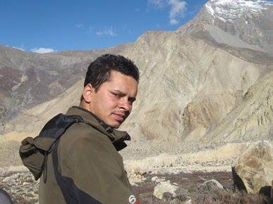
Hello, this is Janardan Mainali, a Fulbright Scholar from Nepal pursuing Masters in Geoscience here at University of North Carolina at Wilmington. I have a Master’s degree in Botany from Tribhuvan University, Kathmandu. My special interest is in analyzing spatiotemporal pattern of ecological processes. I expect to use Geographic Information System (GIS), Remote Sensing (RS) and quantitative tools to unearth the hidden patterns in our natural and social ecosystem. My specific interest is in the relationship between climate and ecological processes across time and space. During my time in the UNCW SEAL (lab), I will be working on some of the above mentioned topics in the regions like Nepal Himalaya and other parts of the world. I have worked in many parts of the Nepali Himalaya including Everest National Park, Manaslu Conservation Area, Annapurna Conservation Area etc. Previously, I was a researcher and GIS trainer at Research Solutions Nepal (ReSoN), which is research service provider enterprise established in collaboration with colleagues in Nepal in 2012. This organization provides training in research related issues and also conducts independent research projects. I am also working as an executive member of Research and Development Society, Nepal, a nonprofit organization. I also administer the Facebook Group named Research Forum Nepal (https://www.facebook.com/groups/ReFoN/). I also have experience working for a year in the Resources Himalaya Foundation as a GIS research associate.
So ready for a ride, let’s see where I will be!!
UPDATE: Janardan completed his Master's thesis in May 2016 and is currently completing his PhD in Geography at Portland State University.. His final MS Thesis project was entitled: " Spatial Assessment of Climate Vulnerability in Nepal: Exploring the Role of Multiple Scales and Approaches".
Publications resulting from Janardan's thesis work:
Mainali*, J. and Pricope, N.G. 2017a. Spatial assessment of climate vulnerability in Nepal: exploring the role of multiple scales and approaches. Applied Geography 82: 66-82.
Mainali*, J. and Pricope, N.G. 2017b. Geospatial datasets in support of high-resolution spatial assessment of population vulnerability to climate change in Nepal. Data in Brief 12: 459-462.
Mainali*, J. and Pricope, N.G. 2018. Mapping the need for adaptation: assessing drought vulnerability using the livelihood vulnerability index approach in a mid-hill region of Nepal. Climate and Development. DOI: 10.1080/17565529.2018.1521329
 DAVID D. GRAYBILL, 2017
I completed my undergraduate degree in December of 2013 at UNCW and received a Bachelor of Arts in Applied Physical Geography with a Geospatial Technology minor. I'm currently seeking a Masters of Science degree in Geoscience with a Geospatial Technology concentration at UNCW. I am excited to work with a drone to obtain location specific high resolution data, and I am interested in land and climate related changes but am uncertain about the specific focus my thesis will take. I love anything outdoors, working on cars and boats and love boating!
David is now gainfully employed as a contractor with ORAU Environmental Protection Agency Sensing and Spatial Analysis Branch as a geospatial analyst in Raleigh NC.
David is now gainfully employed as a contractor with ORAU Environmental Protection Agency Sensing and Spatial Analysis Branch as a geospatial analyst in Raleigh NC.
 STEELE F. OLSEN, 2017
I completed my undergraduate education at UNCW in May of 2016 with a B.S of Environmental Science cum laude with a Biology, Chemistry, and Geospatial Technology minor. I am currently seeking a M.S in Geoscience at UNCW with a concentration in Geospatial science along with a post-baccalaureate certificate in GIS. My research interests include localized high-resolution geospatial data collection methods, fire science, and understanding prescribed fire’s effects on forest structure and ecology. My goal is to understand how UAV collected imagery can be used to influence better decision making and more accurate monitoring within conservation efforts in regards to fire management objectives. High-resolution imagery collected by a UAV rivals traditional aerial mapping, and is cutting edge technology when conducting research at a local level. The longleaf pine ecosystems around Wilmington offer me the ideal study area for my research due to their short fire-regime, well defined vertical vegetation structure, and relatively open canopy. My passions outside the classroom include drumming, hiking, and fishing.
Steele graduated in Fall 2017 and is now gainfully and extremely happily employed with Firmatek, TX as their Director of UAS Operations.
Publications resulting from Steele's time at UNCW:
Pricope, N.G., Mapes, K., Woodward*, K., Olsen, S. and Baxley*, B. 2019. Multi-sensor assessment of the effects of varying processing parameters on UAS product accuracy and quality. Drones 2019, 3, 63.
 LAUREN M. ROSUL
My name is Lauren Rosul and I am first year masters student at UNCW. I received a dual bachelor degree from Florida Institute of Technology in Environmental Science and Oceanography. At UNCW I hope to focus my thesis on local coastal vulnerability to sea level rise, incorporating geospatial data into my study. The oceans interaction with the land is such a complex system that has always been a source for curiosity for me. I have spent most of the last six years observing the many processes that govern the shaping of the coasts. I am very excited to be in Wilmington where I am able to study this very unique environment.
Lauren graduated in Spring 2018 and is now gainfully and happily employed with Dewberry, VA as a resilience and GIS specialist.
Publications resulting from Lauren's thesis and work at UNCW:
Pricope, N.G., Halls, J. and Rosul*, L. 2019. Modeling residential coastal flood vulnerability using finished-floor elevation and socio-economic characteristics. Journal of Environmental Management 237, 387-398.
Pricope, N.G., Halls, J., Rosul*, L., and Hidalgo*, C. 2019. Residential flood vulnerability along the developed North Carolina, USA coast: high resolution social and physical data for decision support. Data in Brief 24 (2019) 103975: 1-7 https://doi.org/10.1016/j.dib.2019.103975
 JESSE SCOPA
JESSE SCOPA I am a M.S. Geoscience candidate in the Department of Earth and Ocean Sciences. I began my college career in September 2015 at Bridgewater State University (BSU). I graduated BSU in the spring of 2020 with a B.A. in Biology and a minor in GIS. The introduction of drones from the geography department completely transformed my career outlook. I was fascinated at the ability and scale drones could be used in conjunction with GIS too generate modern day solutions to environmental and ecological problems. I was one of two students at the time who was interested in remote sensing applications with drones. It was these experiences that encouraged me to pursue higher education at UNCW in Geoscience with the goal of understanding how drones can be used across multiple disciplines. The primary focus of my thesis was Quantifying groundwater outputs into tidal creeks using thermal imagery. In my free time, I enjoy riding BMX and surfing.
My Master’s thesis was completed in July 2022 titled: “QUANTIFYING NONPOINT SOURCE DISCHARGE INTO TIDAL CREEKS FROM UAS THERMAL IMAGERY IN EASTERN NORTH CAROLINA”. A PDF of this thesis project is available here.
My Master’s thesis was completed in July 2022 titled: “QUANTIFYING NONPOINT SOURCE DISCHARGE INTO TIDAL CREEKS FROM UAS THERMAL IMAGERY IN EASTERN NORTH CAROLINA”. A PDF of this thesis project is available here.

Asami Minei: international student from Japan whom I recruited to UNCW after a research presentation I gave at a national conference. During her time at UNCW, she was my lead research assistant on the NCDOT contract and a truly outstanding worker who was hired as a Research Scientist at CUNY New York upon graduation and who just moved back to Japan (May 2022) to start a position as Artificial Intelligence Analyst at a company in Tokyo, https://www.linkedin.com/in/asami-minei-a418aa212/
Publications during her time at UNCW:
Pricope, N.G., Minei*, A. and Halls, J. 2021. Constructing a Coastal Plains wetland delineation model using hyperspatial LiDAR data. IEEE International Geoscience and Remote Sensing: 5896-5898. DOI: 10.1109/IGARSS47720.2021.9555017
Govil**, S., Lee**, A., MacQueen**, A., Pricope, N.G., Minei*, A., and Chen, C. 2022. Using Hyperspatial LiDAR and Multispectral Imaging to Identify Coastal Wetlands using Gradient Boosting Methods. Remote Sensing 2022, 14(23), 6002; https://doi.org/10.3390/rs14236002
Pricope, N.G., Minei*, A., Halls, J.N., Chen, C., and Wang, Y. 2022. UAS Hyperspatial LiDAR Data Performance in Delineation and Classification Across a Gradient of Wetland Types. Drones 2022, 6(10), 268; https://doi.org/10.3390/drones6100268

Thomas Hutsler: joined my lab in Fall 2020 and graduated May 2022 and was immediately hired as a Proposal specialist at Geo Owl LLC Wilmington NC; winner of both research and teaching awards in the Earth and Ocean Sciences Department, thesis work was just published in the journal Remote Sensing: https://www.linkedin.com/in/thomas-hutsler-ab2b42164/
Publications during his time at UNCW:
Hutsler*, T., Pricope, N.G.., Gao, P., and Rother, M. 2023. Detecting woody plants in southern Arizona using data from the National Ecological Observatory Network (NEON). Remote Sensing 2023, 15(1), 98; https://doi.org/10.3390/rs1501009
Publications during his time at UNCW:
Hutsler*, T., Pricope, N.G.., Gao, P., and Rother, M. 2023. Detecting woody plants in southern Arizona using data from the National Ecological Observatory Network (NEON). Remote Sensing 2023, 15(1), 98; https://doi.org/10.3390/rs1501009

My name is Greer Shivers and I graduated with my M.S. in Geoscience concentrating in Geospatial Technologies from UNCW in May 2022. Prior to my graduate studies, I received my B.S. in Environmental Science concentrating in conservation from UNCW in May 2020 and my A.S. from Cape Fear Community College in December 2017. I am a lifelong Wilmington resident who has always been interested in earth and environmental sciences. Growing up on the coast allowed me to learn early on the impacts natural hazards can have on communities, Wilmington in particular, and lead me down the road of seeking out an education that could allow me to work toward protecting my community from such things. My start in the GIS world began when I was lucky enough to be placed in Dr. Pricope’s Introduction to GIS class my second to last semester of my undergraduate program. My desire to study coastal environments and flood inundation lead to Dr. Pricope inviting me to work with her as a research assistant on a NOAA Sea Grant funded project that aimed to identify areas for green infrastructure implementation to mitigate flood risk in coastal areas, particularly along the US southeastern coast. My areas of study were largely shaped by my love of environmental science and the use of remotely sensed and GIS data. I am a Part 107 Certified Remote Pilot who greatly enjoys collecting and working with imagery. Since graduation, I have taking on the position of GIS Analyst for the Wilmington Urban Area Metropolitan Planning Organization which provides transportation planning to the greater Wilmington area and has allowed me the opportunity to branch into the planning world while still working to preserve natural areas from overdevelopment. My career goals are to continue to use my education to champion sustainability, equability, and preparedness in all projects I am involved with. Publications during her time at UNCW:
Pricope, N.G. and Shivers*, G. 2022. Wetland vulnerability metrics as a rapid indicator in identifying nature-based solutions to mitigate coastal flooding. Hydrology 2022, 9(12), 218: https://doi.org/10.3390/hydrology9120218
Pricope, N.G. and Shivers*, G. 2022. Wetland vulnerability metrics as a rapid indicator in identifying nature-based solutions to mitigate coastal flooding. Hydrology 2022, 9(12), 218: https://doi.org/10.3390/hydrology9120218
Undergraduate Student Alumi
 SYDNEY BOHN
Sydney Bohn is currently and undergraduate at the University of North Carolina Wilmington, where she is pursuing a BS in Environmental Science and a BA in Geography.
Her main focus and passion is with GIS and geospatial technologies. She plans to pursue a career in this field post-graduation.Sydney is currently gainfully employed as a GIS Analyst at the Esri Charlotte regional office and loves her job!
Publications resulting from Sydney's work in the lab:
Bohn*, S., Hill*, E., and Pricope, N.G. 2016. Sea level rise hazard assessment for New Hanover County, North Carolina. Explorations (UNC system peer-reviewed undergraduate research journal). Volume XI: pp. 56-75. http://uncw.edu/csurf/Explorations/Volume%20XI/Bohn%20and%20Hill.pdf
 AMELIA C. BRADSHAW
My name is Amelia Bradshaw, and I am currently an undergraduate student at the University of North Carolina at Wilmington. I am pursing a Bachelor’s in Science in Environmental Science with a concentration in Conservation and a Bachelor’s in Arts in Geography. I have always been fascinated by the natural world, devouring books about everything ranging from animal life all around the world to volcanoes, earthquakes and tornadoes. Though I always loved geography, reading National Geographic as a child and looking at maps for entirely too long, I never knew I could have a career in geography until I took my first physical geography class at UNCW after I transferred to the university to pursue a degree in environmental science. After taking that class, I knew I absolutely had to add a geography major to my degree path. This decision was confirmed when I took my first Introduction to GIS class with Dr. Pricope, and I loved it! As I have taken more classes in geography and begun undergraduate research, my desire only grows to learn all I can in this field. I am currently a SURCA Grant recipient for the project “Working with data collected by an unarmed aerial vehicle to model human-environmental interactions”, where I am working with drone data collected in the field in Namibia. Starting in the fall of 2017, I will begin my honors thesis with Dr. Pricope as my faculty advisor, with the goal of pursing a PhD in Geoscience after I complete my undergraduate degree.
Amelia completed an Undergraduate Honors Thesis in Geography, entitled: Examining the relationship between vegetation indices derived from unamanned aerial vehicle (UAV) and PlanetScope high resolution satellite imagery in a southern African drylands ecosystem.
Amelia is now gainfully and happily employed as a GIS Support Analyst a Esri in Charlotte NC.
 HANNAH CHARTER
My name is Hannah Charter and I am in my senior year as an undergrad at the University of North Carolina in Wilmington. I am studying environmental science with a concentration on environmental conservation and am working towards two minors, one in biology and the other in geospatial technologies. After taking Dr. Pricope’s GIS class I decided I wanted to pursue geospatial technologies further and started a DIS with her. I have been working with Dr. Pricope to create different maps and layouts for her work that focuses on population changes in the eastern Africa region. I love to travel and explore new places any chance I can get and am excited to see where GIS can take me as I finish up my undergraduate degree.
 EVAN H. HILL
Evan Hill is currently an undergraduate at the University of North Carolina Wilmington, where he is pursuing two B.S in Environmental Sciences and Oceanography with a Geospatial Technologies minor. He is also a member of the Honors College and is the president of the Ukulele Club. He plans to continue his education by working towards a PhD in Coastal Sciences. He then hopes to become a professor and conduct research at a university by the coast.
Publications resulting from Evan's work in the lab:
Bohn*, S., Hill*, E., and Pricope, N.G. 2016. Sea level rise hazard assessment for New Hanover County, North Carolina. Explorations (UNC system peer-reviewed undergraduate research journal). Volume XI: pp. 56-75. http://uncw.edu/csurf/Explorations/Volume%20XI/Bohn%20and%20Hill.pdf
 RACHEL SULLIVAN
I am currently an undergraduate student at the University of North Carolina Wilmington pursuing a Bachelor of Science in Environmental Science with minors in Geospatial Technologies and Biology. I am most passionate about how climate change affects mountainous/glacial landscapes and the indigenous cultures that inhabit the regions, specifically in Arctic, Antarctic and high altitude environments. My career goals involve traveling to remote places and working with indigenous cultures to help mitigate the effects of climate change, specifically from glacial melting, and to document, quantify, and map changes in glacial extent and depth globally through GIS and remote sensing techniques. The latter has brought me to Dr. Pricope’s lab, where I am currently learning how to use GIS to map changes in glaciers and snow extent over time. I plan to pursue a Master’s degree in Geoscience or Glaciology in the near future.
Rachel is now happily empoyed with the National Park Service in Alaska!
Rachel is now happily empoyed with the National Park Service in Alaska!
 JUSTIN A. WELLS
I’m a SEAL undergraduate student working with Dr. Narcisa Pricope through the Spring Undergraduate Research and Creativity Award, while finishing a B.S. in Geology. During the summer of 2016, I worked as an intern with the U.S. Forest Service in the Medicine Bow NF, Wyoming, collecting an inventory to characterize groundwater-dependent ecosystems. My current work focuses on classifying those groundwater-dependent ecosystems using GIS and remote sensing. So far, I have been invited to present this work at two conferences, and received the G. Herbert Stout Award for innovative use of GIS. I grew up in Asheville, NC. The uniqueness of my hometown and the beauty of the Blue Ridge Mountains, left me with a passion for art, culture, and the natural world. As an artist, my passions include writing, music, and occasionally PowerPoint. I enjoy both the cultural and natural aspects of traveling, and avidly pursue my passions for hiking, camping, and snowboarding, and my ambition to see new mountains all over the world.
Justin is now gainfully employed with Esri Redlands, CA Campus as a Insider Sales Representative!
Justin is now gainfully employed with Esri Redlands, CA Campus as a Insider Sales Representative!
 ANDRE WRIGHT
My name is Andre Wright. Geography is my passion and my love for the world knows no bounds. I am senior undergraduate at the University of North Carolina at Wilmington. I am pursuing a B.A. in Geography with a minor in Geospatial Technologies. My areas of focus are remote sensing and GIS and I am currently working on an Honors thesis on predicting inundation dynamics in drylands under Dr. Pricope’s supervision. After I graduate, I plan to pursue a career in either Geospatial Intelligence or Geosensing.
Andre is now gainfully employed as a GIS Analyst with AECOM at Camp Lejeune, NC.
Andre is now gainfully employed as a GIS Analyst with AECOM at Camp Lejeune, NC.
 LAUREN WHITEHOUSE
I'm Lauren Whitehouse, an honor's student pursuing a B.A. in Geoscience and dual minor's in Geospatial Technology and Environmental Sciences. Some of my earliest memories were built around either swimming in lakes and wading in rivers, so it came very naturally to me to enter a field where I would get to study the systems I enjoyed so much as a child. However, I have also always had a spatial mindset; I would always read the atlas in the back of the car on family road trips because I was just so interested in where everything was and the processes connecting events across long distances. I would love to obtain a Master's degree in Water Resource Management or Hydrology, and hope to perform research on how water quality can be enhanced by evaluating non-point source pollution from a holistic and spatial perspective as opposed to trying to treat them as singular sources.
I'm Lauren Whitehouse, an honor's student pursuing a B.A. in Geoscience and dual minor's in Geospatial Technology and Environmental Sciences. Some of my earliest memories were built around either swimming in lakes and wading in rivers, so it came very naturally to me to enter a field where I would get to study the systems I enjoyed so much as a child. However, I have also always had a spatial mindset; I would always read the atlas in the back of the car on family road trips because I was just so interested in where everything was and the processes connecting events across long distances. I would love to obtain a Master's degree in Water Resource Management or Hydrology, and hope to perform research on how water quality can be enhanced by evaluating non-point source pollution from a holistic and spatial perspective as opposed to trying to treat them as singular sources.